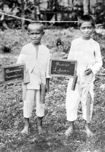
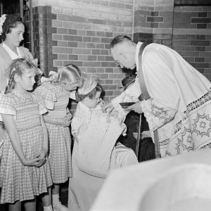
Identity is more than a name. Just because two records show the same name, does not mean they are for the same person. The reverse is true too. Just because two records show a different name, does not mean they are for different persons. People could use different names throughout their lifetime. Some examples: Some people used patronymics and later adopted a surname. They might be listed under their patronymic in one record, and under their surname in another. Some people … [Read more...]
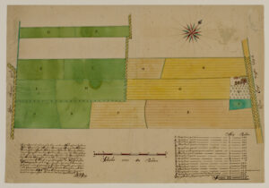
Map of the Week – Border between Gelderland and Munster near Winterswijk, 1656
This week's map was created in 1656 as part of a conference to settle a boundary dispute between Gelderland and Munster. Around Winterswijk, the border area was covered in moors, and it was unclear where Gelderland ended and Munster started. Farmers from both sides were continuously arguing over who had rights to graze sheep there or collect sods and firewood from those common areas. Nicolaas van Geelkercken was tasked with creating maps showing the border according to Gelderland sources. One … [Read more...]
New Netherland Settlers Project
The New York Genealogical and Biographical Society just announced an exciting new project. They launched a multiyear project to develop detailed, peer-reviewed sketches of all the people residing in New Netherland prior to 1664. I am proud to announce that I will be one of the researchers on the project. I will prepare sketches, review and select source material, and advise the project about the information architecture and direction, and scope. I will be working on the project … [Read more...]
Map of the Week – Schermer land reclamation, 1635
This map shows the Scher-meer [Scher lake, also called Schermermeer], a lake that was drained between 1633 and 1635 to claim land. The map shows how this was done: a dike and ditch were built around the lake. Mills would pump water out of the lake, across the dike, into the surrounding ditch, from where it was carried to rivers and ultimately to the sea. Smaller ditches would criss-cross the lake to drain the land. The mills had to continously pump or the lake would fill up again. The Dutch … [Read more...]
Dutch Genealogy News for May 2024
This is an overview of all the new sources, projects, and other news of the past month. Sources Gelderland birth records (1913-1922), marriage records (1943-1947), and death records (1961-1972) have been scanned and indexed and can now be consulted via the Gelders Archief. That includes the birth records of my grandparents. This completes the project "Van de Wieg tot Graf" [From Cradle to Grave] that started in 1998 to index the Gelderland civil registration records. 421,264 scans have … [Read more...]
Map of the Week – Siege of Breda, 1624-1625
Wars often lead to the creation of maps. This week we are looking at a map of the siege of Breda in 1624-1625. The map shows how Breda had been surrounded by a line, just outside the reach of the city's canon. This allowed the attackers to cut supply lines while they besieged the city. This map is of personal interest to me since several of my ancestors lived in this area. One of them had his land confiscated during the siege to build the bank and ditch and fortlets around Breda. Read more … [Read more...]
Dutch term – Common Abbreviations in Dutch Genealogies
Here is a list of abbreviations you may find in published genealogies in the Netherlands. Abbreviation Full version Translation geb. geboren born ged. gedoopt baptized overl. overleden died begr. begraven buried tr. trouwt marries ondertr. ondertrouwt marriage banns ca. circa circa waarsch. waarschijnlijk probably zn. van zoon van son of dr. van dochter van daughter of wed. van weduwe van widow … [Read more...]
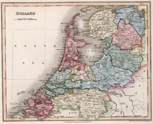
Map of the week – Holland in 1832
This map of Holland appeared in an English atlas in 1832. This is two years after the Southern Netherlands split off to found the independent country of Belgium in 1830, but seven years before the Dutch government acknowledged the loss of these provinces and recognized Belgium as an independent country in 1839. In other words, we can see from the territory on the map that this 1832 map was not created in the Netherlands, since then it would have had the southern provinces too. The map shows … [Read more...]
Ask Yvette – How do I find all the children?
A reader asked me how to find all the children of an ancestral couple. The strategies and sources depend on the period. 1600s, 1700s Sources: Search baptismal, marriage, and burial records to find the baptisms, marriages, and burials of all the children. If one of the parents died before the youngest child was 25, check for guardianship appointments and accounts. Check estate inventories or estate divisions of the parents and grandparents to see which children and grandchildren … [Read more...]
Map of the week: Slangenrode farm near Utrecht
This map shows the Slangenrode farm with its meadows (green) and farmland (green). The farm was located in the Lageweide area between the Huppeldijk and Lageweidsdijk in Utrecht. The map dates from 1718. Although the catalog description does not tell us the purpose of the map, such maps are often created during court cases, for example to settle boundary disputes. You can also sometimes find them as part of estate management records of large landowners, for example map books of all the … [Read more...]
