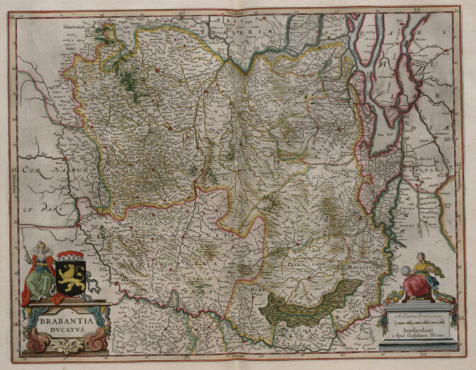
In 1659, the famous mapmaker Joan Blaeu published his world atlas Tooneel des Aardrycks [Display of the Realm of Earth]. The archives in Leiden have made their atlas available online.
This map shows the Duchy of Brabant. It is oriented with the north toward the right. You can see that various places that are now part of the province of North Brabant, such as the area around Willemstad and Heusden, were then part of the province of Holland (outlined in pink). The former Duchy of Brabant is now partially in the Netherlands and partially in Belgium. The Dutch part is now called Noord-Brabant (North Brabant). See the research guide for Noord-Brabant for more information.

Map of the Duchy of Brabant, 1659. Credits: Joan Blaeu, imaged at Erfgoed Leiden (public domain)

