Map of the Week – Joure and Heremastate, circa 1700

This week’s map takes us to Joure in Friesland. The map shows the village of Joure and the nearby Heremastate, a manor house.

In Friesland, a state was a manor, typically owned by a patrician or noble family. These families would often buy properties in the area that had voting rights in the provincial assembly, making them more powerful. Even if you do not descend from these families yourself, your Frisian ancestors may have dealt with them as magistrates, employers, or landlords.
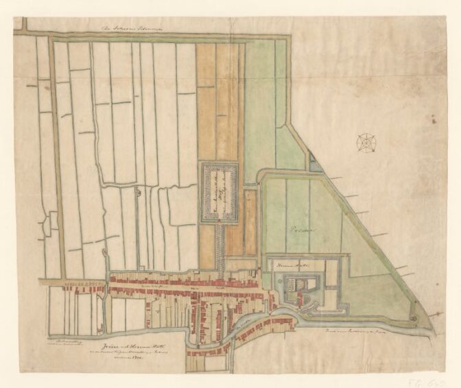
Map of Joure and Heremastate, circa 1700. Credits: Fries Museum (public domain)

About Yvette Hoitink

Yvette Hoitink, MLitt, CG®, QG™ is a professional genealogist, writer, and lecturer in the Netherlands. She has a Master of Letters in Family and Local History from the University of Dundee, and holds the Certification of Genealogist and Qualified Genealogist credentials. Yvette served on the Board of Directors of the Association of Professional Genealogists and won excellence awards for her articles in the National Genealogical Society Quarterly and the Association of Professional Genealogists Quarterly. Yvette has been doing genealogy for over 30 years. She helps people from across the world find their ancestors from the Netherlands and its former colonies, including New Netherland. Read about Yvette's professional genealogy services.

Leave comment

*