In 1585, Braun and Hogenberg published an atlas with maps of different cities in Europe, including many in the Netherlands. This map shows Maastricht. What is nice about these maps is that it shows the people in their local costumes. It shows all the houses in the city, and you can see the different expensions. The detail shows the main church in Maastricht, the St. Servaas. The blue color of the roof indicates it is an untaxed building, usually either religious or city buildings. You can see the old town wall next to the church.
.jpg)
Maastricht. Braun and Hogenberg, 1585, via Wikimedia commons (public domain)
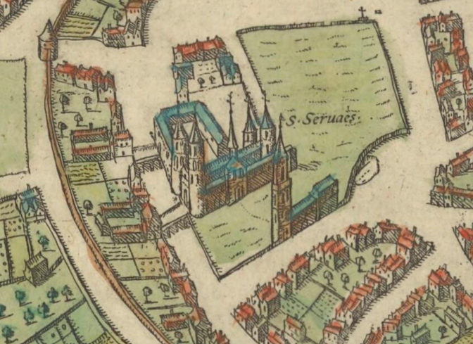
Detail showing the St. Servaas church

")
Congratulations, Yvette, you can be justly proud of all you have accomplished. I would be interested in your dissertation as to why people left The Netherlands in the 1870s. My great grandparents did that with 3 children. Two more children (including my grandmother- 1873) were born in the USA. I believe they came grom Groningen. Congratulations to you once again.
Dear Yvette, congratulations en van harte! Quite an accomplishment with all your other duties. You are a monthly companion, always looking forward to your Dutch letter with information. Hartelijke groeten van Frederice Humphreys.