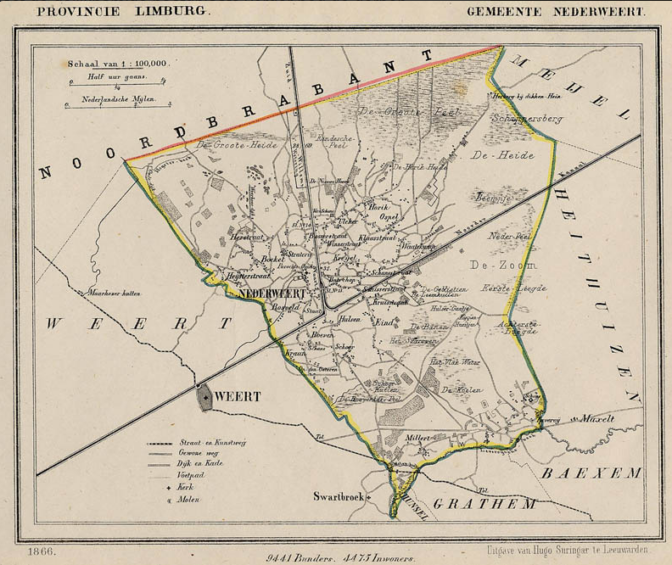
Between 1865-1868, Jacob Kuyper published a series of atlases with municipal maps. These show the location of all the hamlets, villages, and larger towns in the municipality, as well as the main roads and railroads. The Kuyper maps are often available at the websites of archives or via Wikimedia Commons.
Here is an example of such a map, showing Nederweert in the province of Limburg in 1866. You can see the village itself was small, and crossed by two canals. The railroad ran through the southern tip of the municipality.

Map of Nederweert, 1866. Credits: Wikimedia Commons (public domain)


After 3 years of work, in 2007, I stayed at the Golden Tulip in Weert for several days for the dedication of the monument at Ospel to 47 men of the US 7th Armored Division killed in October 1944 in the area. My last night, I had dinner at a restaurant in Nederweert with the local historian whose family sponsored the monument. The battle was vicious and costly as the canals (a new canal not shown on the 1866 now runs south from the canal junction) formed the lines separating the two sides. My father joined 7AD in November 1944 as a replacement for men lost in the battles.
About 2 years later, I discovered that my Evangelisch “German” ancestor from Diepenau was born a Catholic Limburger at Weert in 1700, with ancestors from Nederweert. I had no idea at the time I was there that I was walking, eating, sleeping in my ancestral places. For me, my most personal connection was that it was the place where the men were lost for whom my father came in as a replacement. He was never at Weert or Nederweert, joining when they were at Ransdaal.