This week’s map shows us land that was reclaimed from the sea by building a dike in the north of the province of Groningen. This includes land in the parishes of Hornhuizen, Wierhuizen, Pieterburen, Westernieland, Saaxumhuizen, Den Andel, Breede, Warffum, Usquert, and Uithuizen. The map was created in 1685 and lists all the owners of the land. Maps like this can be a great source of information to learn about property owned by your ancestors.
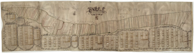
Map of the north diked lands, North Groningen, 1685. Credits: Jannes Tideman, collection Groninger Archieven (public domain)

Detail showing owners

")