Map of the Week – Sewers in Tilburg

This week we are looking at an often overlooked part of our ancestors’ lives: a sewage map. This map shows the network of sewage pipes in Tilburg in 1870.

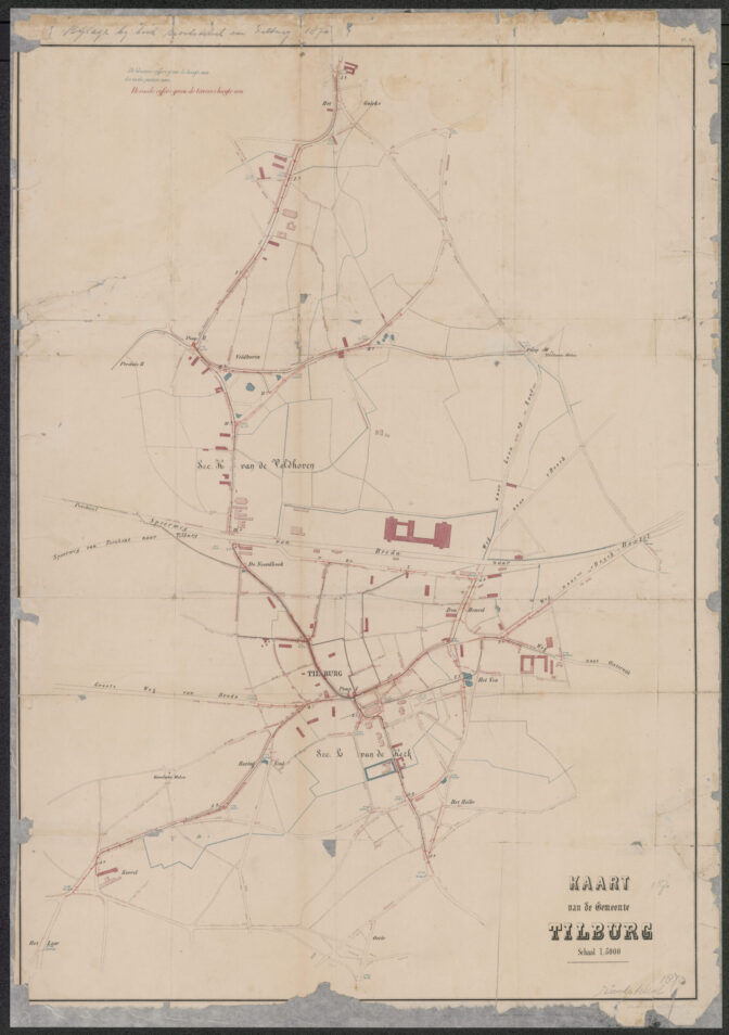
Sewage map of Tilburg, 1870. Credits: Regionaal Archief Tilburg

In the 1800s, many municipalities undertook works to improve public health. The cholera outbreak of the 1860s and the discovery of the role of water contamination by raw sewage led to installation of sewage systems all over the country.

The Tilburg map shows that by 1870, sewage pipes ran through large parts of the center, though that does not mean all huses were hooked up. Few houses outside the village center would have been connected to the sewage system.

About Yvette Hoitink

Yvette Hoitink, MLitt, CG®, QG™ is a professional genealogist, writer, and lecturer in the Netherlands. She has a Master of Letters in Family and Local History from the University of Dundee, and holds the Certification of Genealogist and Qualified Genealogist credentials. Yvette served on the Board of Directors of the Association of Professional Genealogists and won excellence awards for her articles in the National Genealogical Society Quarterly and the Association of Professional Genealogists Quarterly. Yvette has been doing genealogy for over 30 years. She helps people from across the world find their ancestors from the Netherlands and its former colonies, including New Netherland. Read about Yvette's professional genealogy services.

Comments

  1. That’s a very cool map…I swear I could spend my research time just looking at old maps – they’re so fascinating.

Leave comment

*