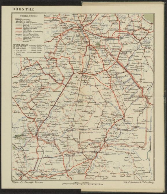
This week we are looking at a map of Drenthe in 1933. It is a tourist map from Sleeswijk’s pocket atlas for the Netherlands for walkers, bicyclists, and automobile drivers, made in 1933. The whole atlas is available at the website of the National Archives in The Hague.
The map shows different kinds of connections:
- Railroads and tram lines in black
- Main roads in wide solid orange
- Brick roads in dotted orange
- Paved roads in narrow solid orange
- Unpaved roads in dashed orange
- Sea and river sikes in sarrated black
- Rivers and canals in blue.
The distance is noted in kilometers.
The map would help tourists travel in Drenthe to see all the sights, such as the prehistoric dolmens. The early 1900s saw in increase in tourism, with the increase of connections and availability of bicycles and cars.

Tourist map of Drenthe, 1933. Credits: call no. MB161, Record Group 4.HEK, collection Hans and Eva Kok, National Archives, The Hague (public domain)


Grootegast is the last place where my 3rd great grandfather tried to become the town coppersmith. He had tried in many towns in Friesdland, and the birth records of the children trace his path. He apparently never succeeded in any town and then moved on to the next. Finally, he left Friesland for what became his last attemtp in Grootegast. When that attempt also failed, he emigrated to Michigan and became a successful farmer.