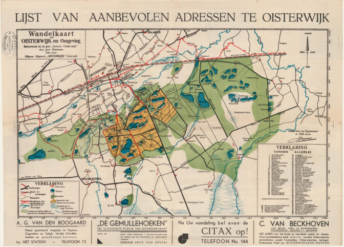
This week we are looking at a tourist map of Oisterwijk from 1933. It is a “wandelkaart” [walking map], which highlights various natural features like lakes (blue), forests (green), national forests (orange), swamps (blue horizontal stripes). It features the hotels in the area and places of interest including churches, a swimming pool, and cafes.
The early 1900s saw the rise of tourism for the middle and upper classes. Railroads allowed people to travel across the country affordably and comfortably. Once they arrived, they would often explore the countryside on foot or by bike. Local tourist guides, including the guide that had this map, would inform people about the local sights.
These guides and maps can show you what the town was like when your ancestors lived there. Like this map, you will often find advertisements for local businesses. For example, A.G. van den Boogaard advertised his shop across the railway station on this map. He sold cigars, cigarettes, tobacco, stationary, and cheap magazines.

Tourist map of Oisterwijk, 1933. Credits: tourist guide Schoon Oisterwijk, collection Regionaal Archief Tilburg (public domain)


Je kunt prachtig wandelen bij de Oisterwijkse vennen en Campina.
Yvette, bedankt voor de kaart van Oisterwijk, veel leuke herinneringen! Ik heb leren zwemmen in het Staalbergven in de Oisterwijkse bossen.