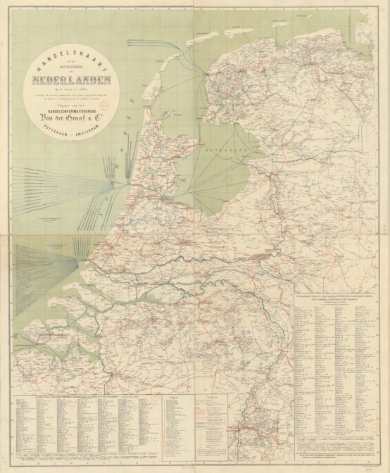
This week we are looking at a map of routes from 1894. Understanding the major connections between cities may help you understand migration patterns. People who travelled along these lines may have met partners in other towns, or found work in a different place. You can zoom in at Gallica.

Trade map of the Netherlands, 1894. Credits: Gallica (public domain)
The map indicates different types of routes:
- Bold solid orange lines represent railroads.
- Bold dashed orange lines represent trams.
- Thin solid orange lines represent streets with regular transportation services (people or goods).
- Blue solid lines represent waterways with regular transportation services (people or goods).
- Green stripes between black lines represent major waterways.

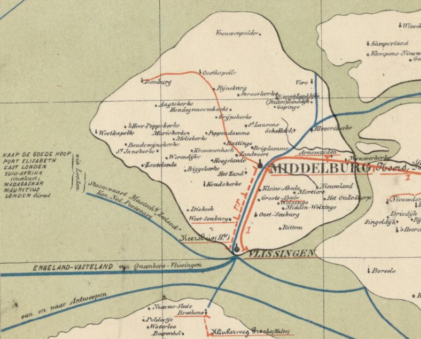
Detail showing island of Walcheren.
If we look at the island of Walcheren, we see the types of details this map reveals. We can see the railroad, connecting Vlissingen and Middelburg to the rest of the country. A tram connects Vlissingen and Middelburg. A regular transportation service is available to Domburg, via a road. The underlined town names are the names of train or tram stations. Towns marked with a black dot with a small vertical line at the top have telegraph stations.
For people tracing emigrants in this period, the map provides information about regular services to different countries. From Vlissingen, people could sail to London, and from there to Cape of Good Hope, South Africa, Madagaskar, and Mauritius. The map indicates the shipping companies that operated these lines: The Stoomvaart Maatschappij “Zeeland” [Zeeland shipping company] and the Koninklijke Nederlandse Postvaart [Royal Dutch Postal Sail Service]. Knowing the companies can help you track passenger lists or ship’s logs.
The bottom left and right of the map shows overseas connections from Amsterdam and Rotterdam, respectively. It provides codes for the routes and the shipping companies who operated the routes.

