Map of the week – Water boards in Drenthe, 1958

This week, we are looking at a map of waterschappen (water boards) in Drenthe in 1958.

In the Netherlands, are responsible for the management of water, including flood prevention and drink water. Each region has its own water board. The boundaries of the water board are often determined by features in the landscape, such as rivers or dikes. The area covered by a water board can differ substantialy from the division in municipalities.

The map shows that the boundaries of the water boards in Drenthe were changing in 1958. The map shows the regions of eight existing water boards and three new water boards.

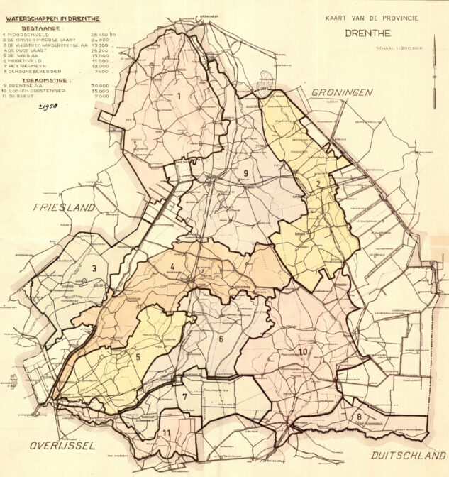
Water boards in Drenthe, 1958. Credits: collection Drents Archief (public domain)

About Yvette Hoitink

Yvette Hoitink, MLitt, CG®, QG™ is a professional genealogist, writer, and lecturer in the Netherlands. She has a Master of Letters in Family and Local History from the University of Dundee, and holds the Certification of Genealogist and Qualified Genealogist credentials. Yvette served on the Board of Directors of the Association of Professional Genealogists and won excellence awards for her articles in the National Genealogical Society Quarterly and the Association of Professional Genealogists Quarterly. Yvette has been doing genealogy for over 30 years. She helps people from across the world find their ancestors from the Netherlands and its former colonies, including New Netherland. Read about Yvette's professional genealogy services.

Leave comment

*