This week we are looking at a map of Drenthe in 1933. It is a tourist map from Sleeswijk's pocket atlas for the Netherlands for walkers, bicyclists, and automobile drivers, made in 1933. The whole atlas is available at the website of the National Archives in The Hague. The map shows different kinds of connections: Railroads and tram lines in black Main roads in wide solid orange Brick roads in dotted orange Paved roads in narrow solid orange Unpaved roads in dashed orange … [Read more...]
Map of the week – Water boards in Drenthe, 1958
This week, we are looking at a map of waterschappen (water boards) in Drenthe in 1958. In the Netherlands, are responsible for the management of water, including flood prevention and drink water. Each region has its own water board. The boundaries of the water board are often determined by features in the landscape, such as rivers or dikes. The area covered by a water board can differ substantialy from the division in municipalities. The map shows that the boundaries of the water boards in … [Read more...]
New website: Alle Drenten
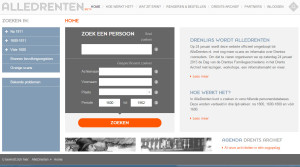
A new website launched this week: Alle Drenten (all people from Drenthe). Drenthe is a province in the north-east of the country. Many people from other regions lived there too, as it was home to the pauper colonies where beggars, vagrants and prisoners were sent to. The new website is the successor of DrenLias. It contains all the indexes that were available on the old site, and it now includes scans of the original records, just like the similarly-named websites Alle Groningers and Alle … [Read more...]
Drenthe Research Guide
Drenthe is a province in the north-east of the Netherlands. It borders on the province of Groningen in the North, Germany in the east, Overijssel in the south and Friesland in the west. The capital city of Drenthe is Assen. Other large towns are: Emmen Hoogeveen Meppel … [Read more...]


